Olidan's Reflex trails
Trollhättan
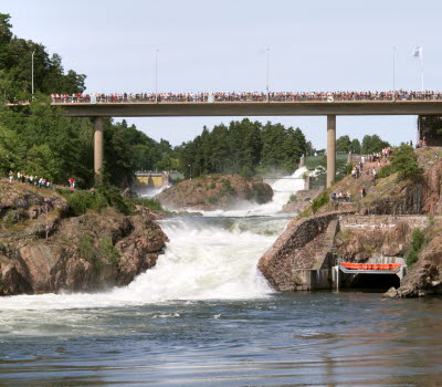
Olidans Reflex trails are three interconnected trail tracks that run in Älvrummet nature reserve, starting from the car park opposite Olidan's power station. Here you experience trail hiking or running in exciting terrain surrounded by magnificent and varied nature and along the way you will see several of Trollhättan's most popular sights.
Quick facts
Length: 7.2 km
Time required: 50 minutes
Difficulty: Medium
Terrain: Nature trails in uneven terrain. Stairs.
Start with a view of Olidan's power station
Start on the trail from the car park on the other side of the water from Olidan's power station. Enjoy the view of the beautiful brick building and the sound of the water while you get ready for a wonderful walk or run in the nature reserve Älvrummet's nature. You then go straight ahead from the car park on the trail which then goes to the left. Follow the water and then cross the suspension bridge that crosses the Göta River.
Photographer: BildIT
Kopparklinten and Älvrummet
When you get over the suspension bridge, turn right and follow the water towards the stairs that lead you up to the beautiful viewpoint Kopparklinten (Copper Cliff). Here you get a lovely view of Trollhättan and the Göta älv river. The trail then takes you along the heights in the nature reserve Älvrummet's western part and then back to the suspension bridge along the water of the Göta River and on the other side you continue into the beautiful magic forest on the east side of Älvrummet. Follow this all the way down to Trollhättan's lock area.
Photographer: Roger Lärk
Trollhättan locks area
The trail then takes you to the locks area where you pass the older staircase locks and with a view of the new ones in varied terrain. At the oldest 19th century locks, there are partly narrow passages when you walk or run along the old staircase lock. Then the trail goes back through the forest area on the so-called Träbrostigen (Wooden bridge path) all the way to the parking lot at Olidan power station. When you arrive, you have covered a distance of 7.2 km
Fact about the trail
Length:
7.2 km
Approximate times:
A quick run can take about 25-30 minutes. Otherwise, count on about 50 minutes.
Marking:
The trails are marked with reflexes and are kept updated during the dark period of the year.
Level of difficulty:
Medium difficulty. Partly high altitude difference and uneven terrain in gravel or nature trails.
Start and end:
Start and finish from the car park opposite Olidan's power station.
How to get here:
The car park at Olidan's power station is just under 2 km from the center of Trollhättan and you can easily get here on foot, by bike or car. Cross the Klaffbron bridge over the canal and then turn left and follow Åkersbergsvägen street to Olidan's power station. If you walk, you can follow the long stair down, otherwise you can follow Olidevägen street down to the car park.
Map:
A digital map of the trail can be found on Google Maps.
You can also see an overview of the separate trails with height differences etc. at www.aktivoresjo.se
Aktiv Öresjö
Trollhättan
Phone: +46 709 28 38 72
E-mail: info@aktivoresjo.se
Website: aktivoresjo.se/


