Nils Ericson´s Walk
Trollhättan
Discover Trollhättan's lock area while you take a relaxing walk among beautiful nature. Nils Ericson's walk is a 1.6 km long walk that shows the area but also allows you to pass several interesting buildings and places along the way.
Quick facts
Length: 1.60 km
Time required: 25 minutes
Difficulty: easy-medium
Terrain: Mostly flat paved, dirt or gravel roads. A couple of major height differences. One section has narrow passages but there is an alternative route.
Trollhättan's lock area now and then
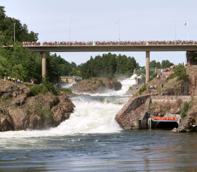
This trail takes you for a walk among the locks, which is without a doubt one of Trollhättan's most visited excursion destinations. In this unique environment, you get to learn more about three generations of lock systems, created based on the ships' need to get past the Trollhätte Waterfalls. The lock area together with the Trollhätte falls is a unique natural and cultural environment and a living world-class industrial memory. The area has been of crucial importance for the city's emergence through the conditions for traffic connections and power production that existed by the Göta River. Along the walking trails there are signs that tell more.
Start your walk from outside the Kanalmuseet (the Canal Museum). Here you find parking spaces if you come by car and if you come on foot or by bike, Kanalmuseet is the first thing you see when you come down to the area from the center on the west side of the canal.
Photographer: Okänd
Staircase Locks and Gamle Dal
Follow the street south from the Kanalmuseet (the Canal Museum) until you come to a small bridge, from here you can look out over the oldest locks from the year 1800, on the right you can see the path that goes along the locks and it is the one you will use on the way back. Continue over the bridge and walk past the summer-open cafe, Slusscaféet, and maybe already now plan a visit here after the pleasant walk? Just to the left of Slusscaféet is the upper lock of 1844, and if you want to make a small detour, you can cross the sluice gate and walk to the upper lock of 1916.
From Slusscaféet you follow the road down along the water, then turn right and follow the sluice stair from 1844 down to the popular green area Gamle Dal. If you also want to see the lower locks of 1916, you can instead choose to go to the left and walk along that sluice stair, however, there are many stairs.
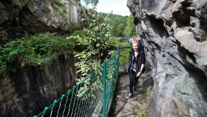
In Gamle Dal there are plenty of places to sit down on the grass or a bench with something good to eat and enjoy the fantastic environment around the old locks. Only a hundred years ago, the place was bustling with life as the wooden ships slowly made their way through the beautiful surroundings. Then continue back along the oldest locks from the year 1800 back to the bridge were you were at at the beginning of the walk. This last bit contains some narrow passages and uneven ground, so if you want to avoid this, read more under the section "Difficulty" further down.
Who was Nils Ericson?
Nils Ericson (1802-1870) was a Swedish baron and engineer. Between 1830 and 1844, his main activity was connected to the Trollhätte canal, and in 1837, Nils Ericson made an adopted plan for the canal's rebuilding, which led to the 1844 locks system. After the canal was completed, Ericson remained head of the Trollhätte Kanalverk until 1866.
Fact about the trail
Length:
Nils Ericson's walk is 1.6 km long.
Approximate times:
A walk at a leisurely pace without stopping takes about 25 minutes.
Level of difficulty:
Most of the trail is easy on flat dirt and gravel roads, but with some level differences. The last part at the 1800 lock system, however, goes in smaller passages where you have to bend and the ground is uneven. If you want to avoid the last part, you can at the lower lock at Gamle Dal go up to the parking lot and follow the street Vassliden street back to the Kanalmuseet (the Canal Museum).
Start and end:
If you start your walk from the west side of the Trollhätte canal, the Kanalmuseet is a good starting point. Here is parking for cars and you can easily get to the walk by following the street south from the museum.
If you start the walk from the east side, there is both a parking for cars and motorhome parking spaces. You then only need to go over the sluice gate and then you are on the walk and can turn left and go towards the lower staircase locks.
How to get here:
The walk is located in Trollhättan's lock area, which is approximately 2.6 km from Drottningtorget square in the city center. You can choose to either cross the Klaffbron bridge in the center and then turn left and follow Åkersbergsvägen street all the way down to the west side of the lock area and the Kanalmuseet (the Canal Museum).
Otherwise, from Drottningtorget square you can follow Drottninggatan street down towards the Innovatum District, at the roundabout you turn right and continue on Åkerssjövägen street and then follow the road until you reach the car park and the motorhome parking on the lock area's east side.
Map:
A digital map of the walk can be found on Google Maps.
An overview map of Nils Ericson's walk and sights along the way can be downloaded here (PDF).
Innovatum Science Center
Åkerssjövägen 16
461 53 Trollhättan
Phone: +46 520 289 400
E-mail: Send e-mail
Website: To homepage


