Hiking in Älvrummet
Trollhättan
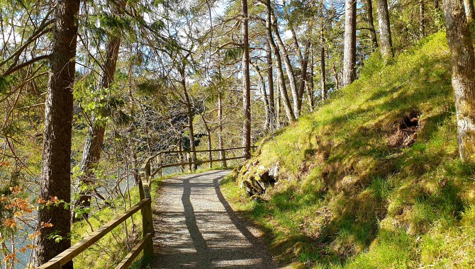
Hiking in Älvrummet nature reserve combines two popular trails; Kärlekens stig (Path of Love) and Träbrostigen (Wooden bridge path) which is located in the eastern part of Älvrummet. Follow one trail and take the other back to where you started and at the same time get a varied hike. Combine deep forest environment with hiking right by the water.
Quick facts
Length: 2.5 km
Time required: 30 minutes
Difficulty: medium
Terrain: Nature trails in hilly terrain
Träbrostigen (Wooden bridge path)
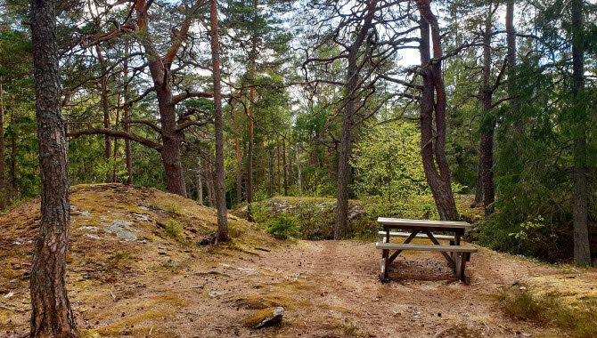
Hike over wooded mountain land that offers some hilly terrain in some parts but otherwise comfortable walk on forest path. Here you walk in deep forest and can enjoy the silence and tranquility. If you start from the car park at Olidan powerstation, go south until you reach Trollhättan locks area. Here is even more to see such as the three staircase locks from 1800, 1844 and 1916. In the summer, it is also a good idea to stop at Slusscaféet, (summeropen café) and enjoy a shrimp sandwich before the hike continues back along Kärlekens stig.
Kärlekens stig (Path of Love)
Feel the romance at Kärlekens stig that follows the waters of the Göta River through Älvrummet nature reserve. The trail is named for the tranquility and cozy atmosphere that surrounds the path with the water on one side and the forest on the other. You walk on a well-trodden path, partly hilly. There are many nice places here if you want to stop for a while for coffee by the water or if you want to try your luck at fishing.
If you want to take a detour, it is recommended that you cross the suspension bridge to the other side of the river, turn right and go up the stairs to Kopparklinten (the Copper Cliff) for a great view of Trollhättan and Älvrummet.
In the middle of Trollhätte Canalpark
Here you walk in the middle of the Trollhätte Canalpark in Trollhättan with the Trollhätte Falls to the north, the locks to the south, the Innovatum District with the Saab Car Museum and the Innovatum Science Center to the west and the Göta River to the east. Combine a hike in Älvrummet with visiting, for example, Kopparklinten on the other side of the river, a walk along the staircase locks or see the waterfall during the summer (due to the ongoing energy crisis there will not be any release of water in the falls during summer 2023 except from during the Fallens Dagar (Waterfall Days) festival 21-23 July).
You can easily get here either by car, bike or walking from the city center. There are car parks both at the lock area and opposite Olidan power station.
Fact about the trail
Length:
Kärlekens Stig and Träbrostigen are together about 2.5 km.
Approximate times:
The trail takes about 30 minutes to walk around.
Marking:
Signs are available at the start of the trail with either Kärlekens stig or Träbrostigen, just choose which one you want to start with. Maps are also available in the area to help you navigate. Träbrostigen is marked with posts with orange markings.
Level of difficulty:
Medium difficulty. Nature trails in hilly terrain and forest environment. Träbrostigen has stairs and footbridges.
Start and end:
Start the walk either from the car park opposite Olidan power station or from the car park at Trollhättan's lock area.
How to get here:
The area is about 2 km from the center of Trollhättan and you can easily get here by car, bike or by walking.
Map:
A digital map of the trail can be found on Google Maps.
Trollhättans Stad
Gärdhemsvägen 9
461 83 Trollhättan
Phone: +46 520 49 50 00
E-mail: Send e-mail
Website: To homepage


