Hiking on the Koster Islands
Strömstad
The Koster islands are a walker’s dream. Enjoy the stunning scenery from the marked paths and trails, or from the various resting spots. At the Koster boat landing piers there are information signs with maps of routes and trails.
There are orienteering maps at the piers and around the routes. You can also down load a hiking map with marked trails here.
Photographer: Roger Borgelid
Hike on North Koster
North Koster is characterised by its desolate nature, rough waves and striking geology – not to
mention its two lighthouses. Its landscape shows many traces of the most recent ice age. The north
of the island ofers views of the Kosterhavet national park.
There are three marked circular routes that take you easily around the island;
- Yellow trail 5,3 km, a beautiful walk that loops around the north of the island.
- White trail 1,3 km and the route cross on the north of the island yellow trail.
- Blue trail 2,3 km, takes you across the clifs and cobbles to the southernmost part of North Koster.
The trails on North Koster are inaccessible to wheelchairs or prams, except for the white one: on that trail, lifting your pram a few times lets you take it to Norrvikarna.
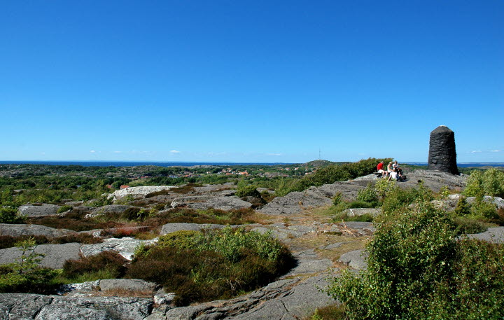
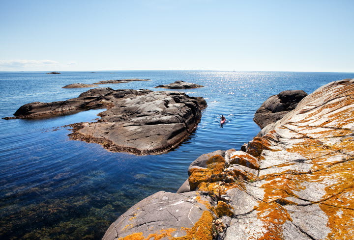
Look out for: the shingle fields at Valnäsbukten (bay) are a stunning remnant of the ice age and the sea that formed the ramparts as the Kosters rose from the sea. Keep your eyes close the ground at the Valnäs marshes to spot the unique little Bohusranunkel plant. Visit Kosters highest point at Högen where there are two former lighthouses at almost 60 metres above sea level for fabulous views.
Photographer: Roger Borgelid
Hike on South Koster
On South Koster, the largest of the Koster Islands, you’ll walk through lush scenery, with deciduous woodland, flowery coastal meadows and long sandy beaches perfect for a dip. Many parts of South Koster can be reached by road.
The majority of the island’s trails are inaccessible to prams and wheelchairs.
There are three marked circular routes that take you easily around the island;
The blue trail, 13,1 km takes you around all of South Koster.
Read more about the trail’s diferent sections below. Here and there, you can take an easier route.
Långegärde – Ekenäs, 3.3 km
This is a popular route that includes stretches of shoreline, winds through a forest and past open meadows and arable land. The last stretch from the main route connects with another path and you follow the blue/yellow marked trail back to Ekenäs.
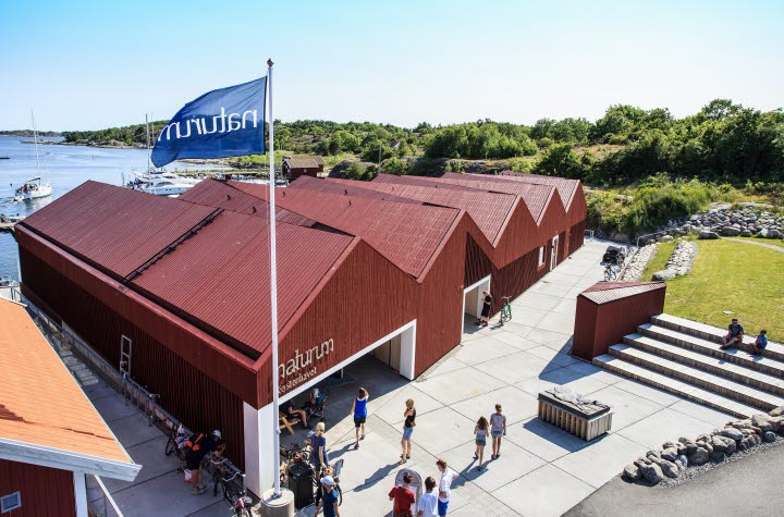
Look out for: Rare Bohuslinden (lime tree) at Ekenäs that is signposted from the tennis court. Naturum Kosterhavet exhibition, fish smokehouse (Rökeriet) and Kosters’ only hotel, at Ekenäs.
Detours: At Rörvik, north of Ekenäs, there is a bathing spot and a snorkel trail. If your feet want to take you further, pay a visit to Kilesand.
Ekenäs - Kilesand 2,7 km
An area of natural beauty in varying landscapes of pastures and ancient deciduous forest. There are bathing spots at Bergdalen and Kilesand. There is a restaurant and ice-cream kiosk at Kilesand.
Kilesand – Brevik, 3,8 km
The trail covers the entire South Koster island on paths, gravel paths and there are many discoveries to be made both on and off-trail. Parts of this section pass through the Kosterhavet
national park. The trail takes you through the charming village of Kyrkosund. Afterwards, you
enjoy stunning views of the Koster archipelago and the national park. The trail then crosses open coastal meadows, towards the colourful boathouses of Brevik harbour.
Brevik - Långegärde 3,3 km
This trail takes you from Brevik harbour up the hill, then on into the forest.
Photographer: Göran Assner
Other useful information
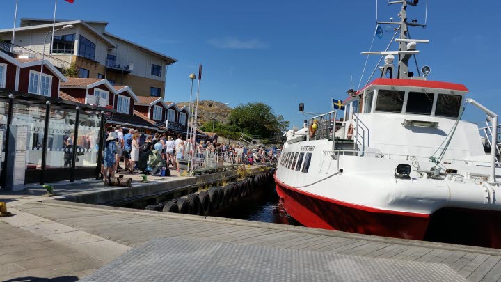
Getting to the Koster Islands: The Koster ferries (Koster Marin) depart from Norra Hamnen in the town of Strömstad year-round. You can purchase a ticket on board, or at the ticket machine in the harbour in Strömstad. Timetable: www.kostermarin.se
Koster cable ferry
Between North and South Koster (Långegärde – Västra Bryggan) there is a small cable ferry that is manned summertime. At other times of the year you can take the Koster boat.
Guided tours
There are guided kayaking and seal-spotting tours in the summer months from the Koster islands. There are also guided tours of the island’s beaches, as well as cultural walks and guided bike tours.
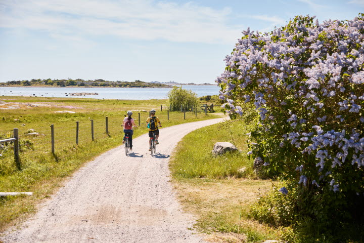
Kosters Trädgårdar: hiking, biking and kayaking
Koster Adventures: Biking and kayaking
Selin Charter: Seal safari
Good to know
The Koster Islands are largely a nature reserve, which means certain restrictions and it is fine to:
- Bring along your dog, but it should be on a leash.
- Build a fire in designated places. Bring your own frewood or charcoal. Feel free to use a
camping stove or your own barbecue. Disposable grills are forbidden, however. - Pull up canoes and kayaks on shore as long as they are not positioned so that they block swimming beaches.
- In South Koster and North Koster, pitching a tent is not allowed, except in campsites
But you may not:
- Bike or operate motor vehicles anywhere but on designated roads.
- Pull up or moor your boat or anchor closer than 50 metres from swimming beaches.
- Take of or landing a drone is not allowed.