
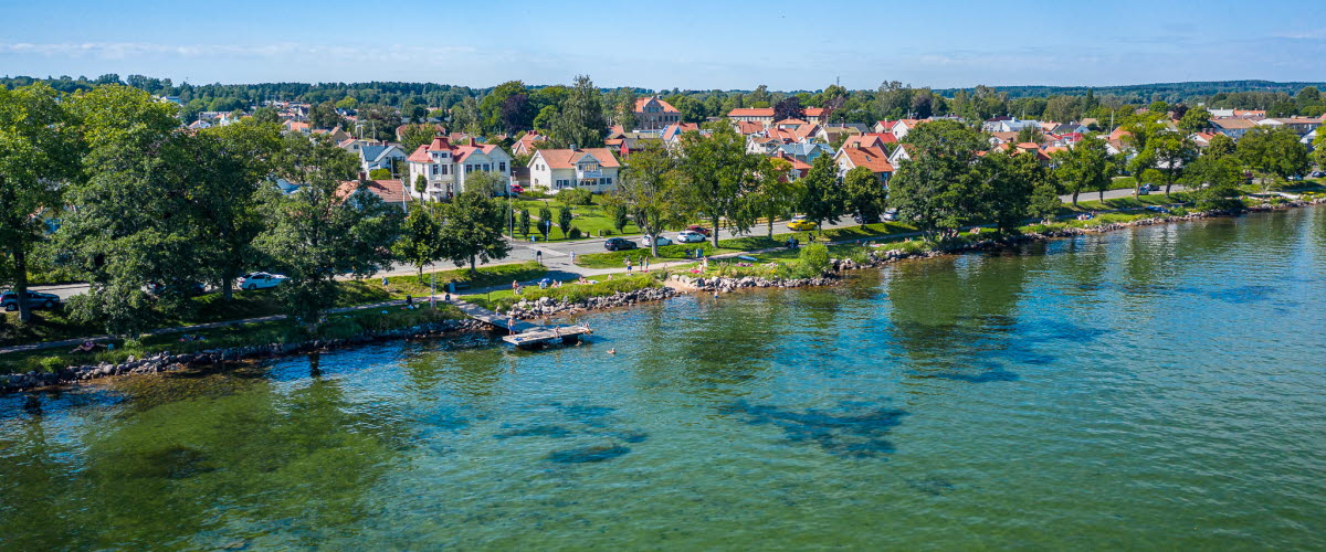
Bathing and more
A pleasant and easygoing cycling tour southwards, where you can stop for a dip in Lake Vättern, buy local food, visit Norra Fågelås Church, dating back to the Middle Ages, and take a detour to the wilderness shelter at Lingonudden.
Easy cycling tour, 24 kilometres, around 2 hours
Quick facts
Length: 24 km
Cycling time: around 2 hours
Level of difficulty: easy
Terrain: The majority on gravel roads, some tarmac sections.
Map for printing:
Digital map:
Facts about the trail
Length:
24 KILOMETRES
Roughly 7 kilometres on tarmac and the remainder on gravel roads.
Alternative route/detour 1 – Bisonfarmen: + 19 km
If you want to challenge yourself and extend your ride, we highly recommend heading to Bisonfarmen. In summer you can call in for a bite to eat and join a fascinating Bison safari. You can find directions for this detour on the digital map.
Alternative route/detour 2 – Lingonudden: + 7 km
If you want a pleasing detour on the way back instead, we recommend heading to the wilderness shelter at Lingonudden. Here you will find a barbecue area with views over the lake. Don’t forget to bring your own wood/charcoal and barbecue rack. You can find directions for this detour on the digital map.
Alternative route – Shorten your route
If you would like a shorter route, turn off at Almnäs up to Korsgården, or even earlier at Maple Rock Ranch. The alternative routes can be viewed on the printable and digital map.
Estimated time:
AROUND 2 HOURS
Markers:
NO MARKERS
The trail is not marked out in the countryside.
Level of difficulty:
EASY
An easy cycling tour – numerous flat sections and a small number of ups and downs.
Start and finish:
KULTURKVARTERET PEDAGOGIEN
Begin and end your trip at the car park behind Kulturkvarteret Pedagogien >>. You will find free long-stay parking here, where you can conveniently park for the day.
Getting here:
PUBLIC TRANSPORT
You can take the bus to Hjo (service 402, 405). Public transport services in the Västra Götaland region are provided by Västtrafik. What about bikes on board? Find out more here>>
TRIP PLANNER
CAR
It’s easy to get to Hjo by car. Hjo is situated around 40 minutes north of Jönköping, 30 minute east of Skövde and just under 2 hours south of Örebro.
Map:
MAP FOR PRINTING
A printable map is available for downloading as a PDF. You can also purchase a copy at Visit Hjo – Tourist information.
PRINTED
DIGITAL MAP
You will find our map online via Google maps >>
ONLINE
SUGGESTIONS FOR INTERESTING PLACES TO VISIT
On our maps, both the PDF map and the digital version, you will find suggestions for places to call en route – local sights, farm shops, refreshment spots and impressive viewpoints, to add to the overall enjoyment of your cycling tour. Of course, you don’t have to stop if you don’t want to – after all, the journey itself is also an experience.
NEED TO HIRE A BIKE?
You can hire bikes from Whatsup Rental in Hjo Stadspark. This is affiliated with Restaurang Biergarten and you can hire kayaks, stand-up paddle boards and cycles.
WHATSUP RENTAL
WHAT TO PACK?
Clothing
Take note of the weather forecast and pack appropriate clothing. You always get a little warmer once you have been cycling for a bit and got your heart pumping, but when you stop, you soon cool down – so bring something warm to throw on (for your top half at least). If you fancy a swim, don't forget to pack your swimwear and ideally something to sit on – a blanket, sleeping mat or towel.
Food and drink
Depending on how many stops you plan to make en route and for how long, it’s a good idea to bring along something to eat and drink. You can purchase a ready-made picnic basket from Whatsup Rental/Biergarten >> or buy a classic Italian anti-pasti platter from Gusto Classico >> to go. Or pick up some treats from one of our local cafés >>.
WHAT IS TRAFFIC LIKE ALONG THE ROUTE?
You will largely be travelling on gravel roads, where there may be some traffic, occasional tractors. In general there will be more traffic on the tarmac country lanes than on the gravel roads. By all means get off your bike to allow traffic to pass to ensure a safer outing. You can tell what types of roads you will be cycling along from our printable map.
Contact information
Suggested tour – Visit Hjo
Bangatan 1 B
544 30 Hjo
Tel: +46 503 352 55
E-mail: visithjo@hjo.se
Website: visithjo.se
Suggested tour – Lake Mullsjön
Easy cycling tour, 17 kilometres, around 1.5 hours
Suggested tour – Forest loop
Moderately difficult cycling tour, 26 kilometres, around 2.5 hours
Cycling and hiking tips
Hjo offers plenty of options for those who enjoy cycling and hiking. The nature trail up to Lake Mullsjön covers several kilometres and offers the attraction of…